
|
Munglinup River |
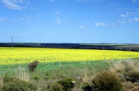
The river lies generally within a vegetative corridor. The water flows for only short periods each winter, or only negligibly in dry winters, and is naturally brackish to saline.
Further Information:
Ernest P. Hodgkin and Ruth Clark: Estuaries and Coastal Lagoons of South Western Australia: Stokes Inlet, Oldfield Estuary and Ten Others. Environmental Protection Authority, Perth, Western Australia: Estuarine Studies Series No. 5 June 1989.
South Coast Regional Land and Water Care Strategy: The Esperance-Sandplain Sub-region. Prepared by: the South Coast Regional Assessment Panel and the South Coast Regional Initiative Planning Team, February 1997.
Oldfield Catchment 1998. Report prepared for the Oldfield Landcare Group